
New Pattern Suggests Two “Sizable” Snow Events For US Northeast
Meteorologist Mike Masco has identified what he says could be a very active storm pattern for the Northeast and Mid-Atlantic from around New Year’s Day into mid-January.
“I’ve been deconstructing the pattern this morning, and there are three key features that support an active stretch across the Northeast and Mid-Atlantic, including the potential for at least two sizable snow events, plus several smaller ones,” Masco wrote on X.
Masco is a meteorologist for New York City-based PIX11 News and focuses on the Northeast and Mid-Atlantic regions.
He explained what the active post-New Year pattern could bring on a region-by-region basis:
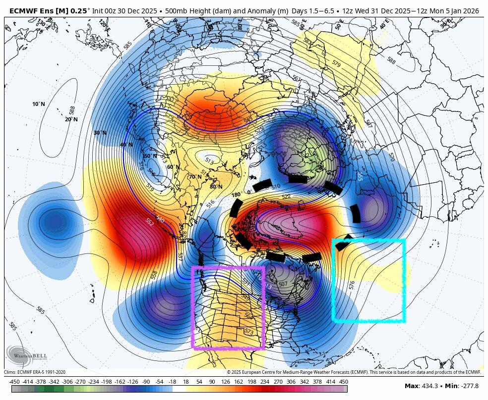
• West-based negative NAO (Greenland block), shown by the black circle, slows the pattern and reorients the jet stream from southwest to northeast, and at times south to north. This keeps shortwaves and lows closer to the coast. It is not a guaranteed blockbuster, but it keeps inverted troughs and sneaky coastal setups in play, with one possible around New Year’s Day.
• Rockies ridge (critical), shown by the purple box, forces storm energy south of New York City and Philadelphia. Without it, storms track north and turn weaker and wetter. With it, colder tracks and better snow potential are more likely.
• Western Atlantic ridge (underrated), shown by the blue box, helps keep systems near the coast and supports Miller B-type setups, favoring more traditional snowstorms rather than just clippers.
Timing: The pattern sets up around New Year’s Day and lasts into mid-January. There is no locked-in timeline for a major storm yet. A New Year’s Eve or New Year’s Day clipper is likely to bring light snow across the region, with redevelopment potential toward Boston.
Here is Masco’s forecast map:
Peak winter is still several weeks away.
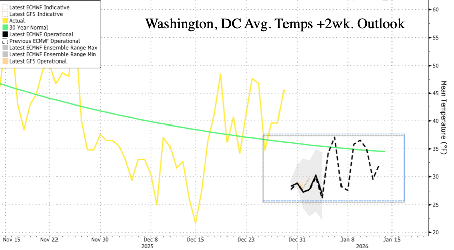
Washington, DC’s Heating Degree Days, a weather-based metric used to estimate how much energy is needed to heat buildings, will be above 30-year averages.
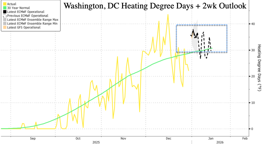
This implies higher NatGas demand, thus higher prices.
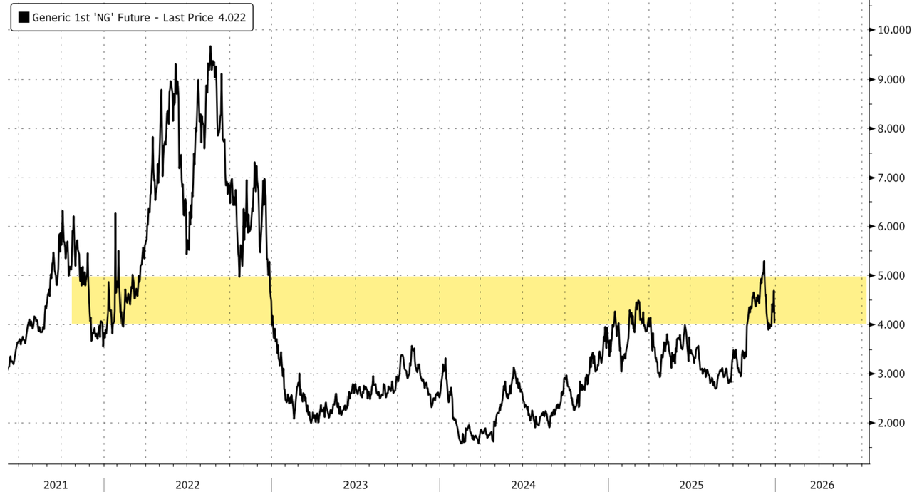
NatGas prices jumped in November and December on cold weather patterns across the US East.
Tyler Durden
Tue, 12/30/2025 – 14:40ZeroHedge NewsRead More
