After Historic Lull In Atlantic Basin, Twin Storms At High Risk Of Intensifying
The peak of the Atlantic hurricane season was observed around Sept. 10, with the season running through Nov. 30.
So far, this year’s hurricane season has been unusually quiet, despite climate activists warning earlier that a so-called “climate crisis” would trigger an extreme season, and that, at all costs, the Western world must ban cow farts and petrol-powered vehicles to prevent planet Earth from erupting into a giant fireball.
Yet here we are: hurricane experts have been bored to death by the lack of storm activity. But as the season enters its final months, activity has finally picked up, with two tropical waves now being monitored in the Atlantic Basin.
Meteorologist Ryan Maue wrote on X, “High chance of both Invest 93L & 94L developing into hurricanes with a risk to the U.S. East Coast from one of them. Major intensity on table for both”
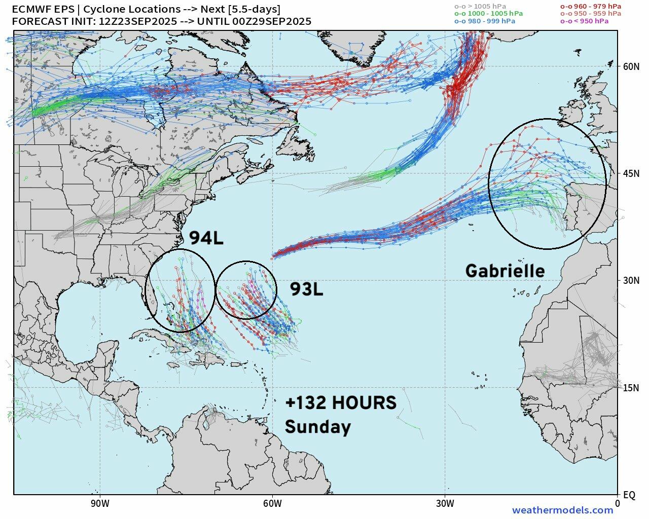
“The “two cyclones” system will likely be dominated by Humberto … as it should be larger and more intense High uncertainty, of course, with “Fujiwhara effect” twin vortex systems … Still potential for land impacts [westward system] to U.S. East Coast over +5-10 day period,” Maue continued.
The “two cyclones” system will likely be dominated by Humberto … as it should be larger and more intense
High uncertainty, of course, with “Fujiwhara effect” twin vortex systems …
Still potential for land impacts [westward system] to U.S. East Coast over +5-10 day period. pic.twitter.com/vkmgrTyFgL
— Ryan Maue (@RyanMaue) September 24, 2025
Other private weather forecasters, including BAMWX, also took to X to warn about the “TWO disturbances in the Atlantic Ocean that are expected to develop into tropical storms & eventually hurricanes over the next few days,” adding, “The further west one is close enough for the southeast US coast to be monitoring carefully.”
We continue to carefully monitor TWO disturbances in the Atlantic Ocean that are expected to develop into tropical storms & eventually hurricanes over the next few days.
The further west one is close enough for the southeast US coast to be monitoring carefully.
Official outlook… pic.twitter.com/dgNpMfL8dX
— BAM Weather (@bam_weather) September 24, 2025
Meteorologist Matt Lanza noted on his Substack that the upper air pattern in the southwest Atlantic is “an utter mess,” which means forecast uncertainty of Invest 93L and Invest 94L increases dramatically.
“The whole pattern bears watching for the East Coast over the next week or so,” Lanza said. “But uncertainty is extremely high, with a lot happening over a small area and any one feature having impacts on the others.”
Commenting on the historic lull in hurricane activity, Philadelphia Inquirer’s Anthony Wood pointed out, “In the era of reliable surveillance, dating back roughly 85 years, such a lull has happened only once before — in 1992, and that was an extraordinary case.”
Tyler Durden
Thu, 09/25/2025 – 05:45ZeroHedge NewsRead More


 T1
T1